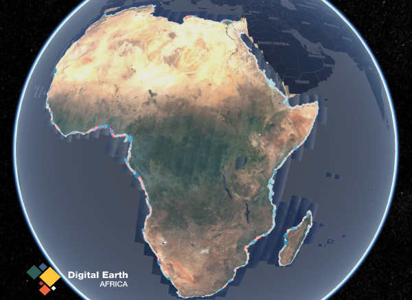
Our Coastlines monitoring service uses satellite data to map the typical location of the African coastline through time. It helps to understand the past changes in the coastline and identify areas of concern for the future. Using the interactive map, users can easily visualise and translate years of satellite imagery into information about the growth and erosion of coastlines across Africa.
Visit the Coastlines Dashboard which maps and tracks the growth and erosion of the African coastline over time, providing vital insights for decision-makers. With data coverage spanning the entire African coastline over the last 24 years, the service is a valuable resource for monitoring and mapping rates of coastal erosion and change, evaluating the impact of coastal management, as well as modelling responses to changing conditions such as extreme weather events and human development.
The Coastlines service covers the entire coastline around Africa. Explore it here on the DE Africa Map.
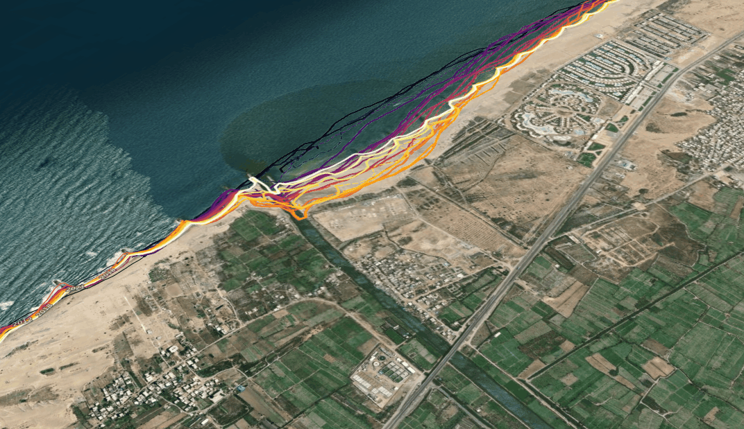
In the past, it has been challenging to access consistent coastline data for large areas. Now, using satellite data available from the year 2000 onwards, users can identify past and present coastline location and monitor the rate of change, trends and identify hot spots of coastlines at risk of significant change. The product combines satellite data with tidal modelling to map the most representative shoreline location and the average sea level tide each year. The coastal retreat and growth can then be examined annually both locally and at a continental scale.
Coastlines are susceptible to a number of drivers that can cause changes in their structure. This includes sea-level rise, extreme weather events or human development. Understanding how the coastline of Africa responds to these pressures is critical to managing the coastline in order to protect the environment, coastal communities and economic value to each region. Coastal erosion is closely linked to a changing climate, as it is highly responsive to rising sea levels, changing precipitation patterns, and higher temperatures. When combined with the impacts of human development it has the potential to cause significant changes to the coastlines of Africa. It is important to ensure that the Land, as outlined in Sustainable Development Goal 15, is protected and restored, and that sustainable use is promoted to halt degradation and biodiversity loss. The Coastline service can empower decision-makers to prioritise and evaluate the impacts of local and regional coastal management based on historical coastline change.
Learn more about the value Coastlines can provide across Africa here.
Coastal erosion occurs when sediment and bedrock is lost from coastlines. This causes beaches, cliffs and mangroves to recede. Whilst coastal erosion is a natural process, human activity such as the introduction of infrastructure both on and around the coastline, and the removal of vegetation on sand dunes can amplify the effects. Using the Coastal Erosion notebook available on the DE Africa Sandbox, users can also undertake long-term monitoring of specific areas along the coast of Africa.
How can you use Digital Earth Africa Coastlines
- Monitor and map rates of coastal erosion along African coastlines.
- Evaluate the impact of local and regional coastal management based on historical coastline change.
- Model how coastlines respond to drivers of change such as extreme weather events, sea level rise of human development.
- Support studies of how and why coastlines change over time.
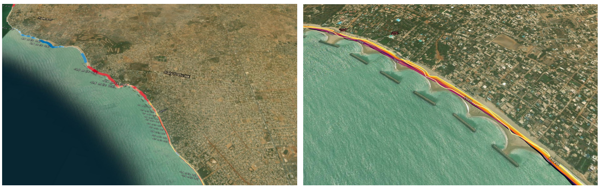
Experts from the Centre de Suivi Écologique (CSE) worked with the Digital Earth Africa team to validate the ‘Coastal Erosion’ notebook and the ‘Digital Earth Africa Coastlines Methods’ that enable users to monitor coastlines across the continent. Using the Senegal Coast the team observed the coastline shifting in Saly Portudal due to human development blocking natural water movement, resulting in coastal erosion that is affecting the local tourist industry. Read more here on our blog.
There are multiple Coastlines data available for the African continent including;
- Millions of km of satellite-derived ~0 m Above Main Sea Level annual shorelines
- Millions of change points across coastal Africa (every 30 m)
- Coastal Change Hot Spots
- The ‘Digital Earth Africa Coastlines method’ and ‘Coastal Erosion’ notebook on the Sandbox.
For more detail, view the product details on Digital Earth Africa Docs or explore the Map.
Coastlines Dashboard