Fractional Cover is a powerful analysis service that describes the landscape by providing a classification of ground cover.
It shows representative values for the proportion of bare, green and non-green cover on the Earth’s surface. This can show changes in seasonal vegetation, environmental conditions and agricultural activities. It also shows where vegetation has been removed or died with a shift to bare earth.
Fractional Cover is derived from Landsat Collection 2 Surface Reflection with daily captures. The service predicts vegetation cover at 30m per pixel and has coverage across the continent of Africa. The basis in Landsat enables data spanning from the 1980s to present to show change detection across decades and long-term comparisons of environmental condition.
Understanding patterns in the condition and extent of vegetation within ecosystems can inform policy, decision making and land management practices. There are a number of notebooks available in the DE Africa Sandbox that are pre-configured for analyses such as wetland insights and land management.
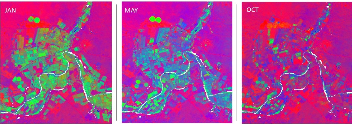
For example, the above series of images show 10 months of fractional cover mapped over Olifants River near Koekenaap in South Africa at 5 month intervals. It shows the growing season with more areas of green, which then dries out to brown and becomes bare earth after harvest. This could be used for multi-year comparison of land management practices or analyses of seasonal trends.
Fractional Cover has the potential to inform a wide range of analyses such as;
- Erosion risk from wind and water
- Soil carbon dynamics
- Land management practices (e.g. crop rotation, stubble management, rangeland management)
- Vegetation studies
- Fuel load estimation to assess fire risk
- Ecosystem modelling
- Assessment of rangeland condition.
The fractional cover algorithm was developed by the Joint Remote Sensing Research Program. This product is accessible through OGC Web Service, for analysis in the DE Africa Sandbox JupyterLab and for direct download from AWS S3.
For a view the full product specification see Digital Earth Africa Docs.