During the first quarter of 2024, Digital Earth Africa presented a set of capacity building workshops and an info session in Madagascar. With its unique ecosystems and rich biodiversity, the island is a jewel located in the Indian ocean off the east coast of Africa. Stakeholders, including government departments, academic institutions, NGOs and the private sector, were provided with a hands-on introduction to the use of earth observation (EO) data as an important tool in the management of critical environmental resources.
Named the EO Capacity Madagascar Project, the set of workshops is an initiative of Digital Earth Africa, funded through the Australian Government Direct Aid Program, via the Australian Embassy in Mauritius. Key country partners include Madagascar's Ministry of Environment and Sustainable Development, and the University of Antananarivo.
The goal of EO Capacity Madagascar has been to support the improvement of observational data exploitation - in the form of freely accessible EO data - to enhance natural resource management and practices in the country.
Critical environmental challenges
With agriculture making up Madagascar’s largest industry, employing 82% of its workforce, it is critical to ensure sustainable environmental management and practices. Additionally, the country holds nine percent of Africa’s mangrove forests, which are the country's powerhouses for carbon capture, biodiversity and natural flood defences. Mining accounts for 32.2% of the total exports of Madagascar. The country holds the world's largest reserves of sapphires and is the 10th largest producer of chromite worldwide. In addition, Madagascar has deposits containing gold, nickel, cobalt, heavy mineral sands, and coal.
Environmental challenges range from mangrove forest degradation, deforestation and soil erosion due to agricultural fires, and the over-exploitation of resources, among others. The wet and cyclone-prone months of February and March can give rise to severe flooding that creates both environmental hazards and socio-economic challenges. There is also a threat to both biodiversity and human settlements through contamination from mine dumps and tailings storage.
Speaking at EO Capacity Madagascar’s official opening ceremony, Max Fontaine, Madagascar's Minister of Environment and Sustainable Development, said that while the government is committed at the policy level to the promotion of smart environmental monitoring, the country currently has a limited number of experts who can harness the opportunities geospatial technologies, including earth observation, present for solving environmental challenges.
Powerful tools to deepen insight and action
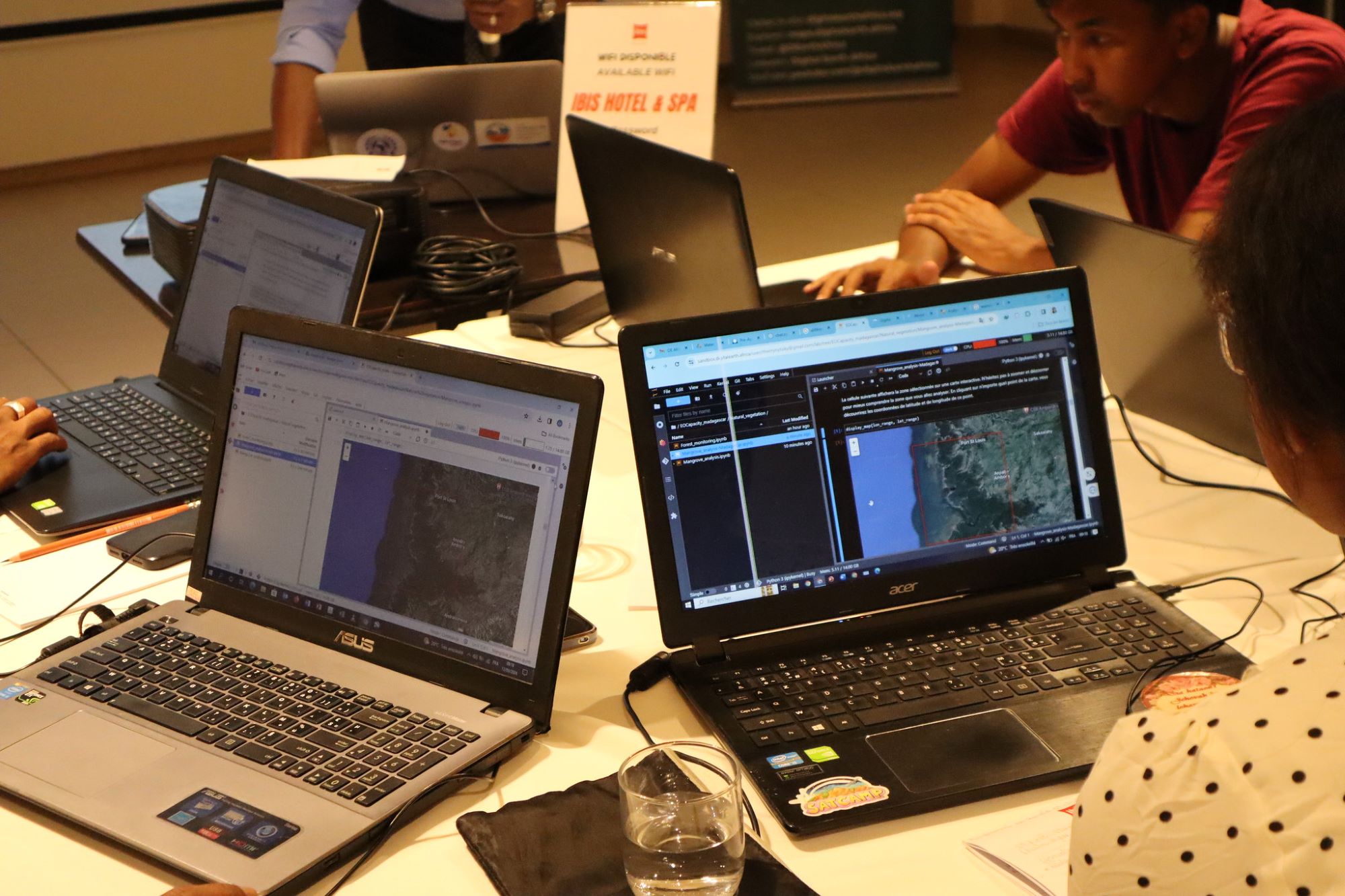
Digital Earth Africa’s capacity building interventions are specifically tailored to the relevance of application for the target users, and this methodology was applied to the EO Capacity Madagascar project. In preparation for the project, which consisted of two workshops and an information session, a survey was disseminated to potential attendees to better understand needs, including environmental concerns and specific areas of interest.
The workshops sought to guide and encourage participants to interact with Digital Earth Africa’s tools and services. This included Digital Earth Africa’s Maps, the powerful, interactive platform consisting of a wide variety of EO data assets that make possible the visualisation of the African continent’s diverse geographies over time.
Participants were also introduced to the Digital Earth Africa Sandbox, which comes with pre-developed python-based algorithms with well-described steps (known as notebooks) and analysis-ready datasets that are accessible even to those without prior coding experience.
Participants were introduced to - and engaged with - Digital Earth Africa’s Water Observations from Space (WOfS) service. Using satellite imagery, WOfS provides historical surface water observations across the African continent, enabling users to understand the location and movement of inland and coastal water over time. It shows where water is usually present; where it is seldom observed; and where inundation of the surface has been observed by satellite.
The workshops provided an opportunity for participants to monitor Madagascar’s water resources; natural vegetation; the expansion and geographical impact of mining activities and natural vegetation, and crop health monitoring. Group work towards the latter part of each session enabled participants to apply their acquired skills with a focus on their domains of expertise and areas of interest.
Specific areas of interest
A number of key areas pertinent to Madagascar’s environment were used to practically understand the benefits of EO data and in particular Digital Earth Africa’s tools and services. Different locations of Madagascar's water resources were viewed and analysed as were specific areas of crop health monitoring, and the exploration of trends in mangrove vegetation. By comparing imagery with the Global Mangrove Watch Database (an online platform informed by the Global Mangrove Alliance), participants were able to ascertain that mangrove vegetation in Madagascar appears to be stable with the exception of small pockets around human settlements.
To understand the environmental effects of mining activities, participants used Ambatovy, one of Madagascar’s largest quarries as a real-world example, and viewed historical trends in nearby forest areas using datasets in the Maps and the WOfS service. Loss of vegetation along with the detection of water were seen as signifiers of deforestation, attributed to the quarry’s mining activities.
These insights are hugely beneficial for decision- and policymaking, as well as informing risk management strategies, and areas of environmental and geographic research.
Building a community of cooperation, knowledge, partners and practitioners
The Deputy Head of Mission at the Australian Embassy in Mauritius, Katie Lalor, said the EO Capacity Madagascar Project cemented the strong relationships between the Australian and Malagasy governmental institutions, and expanded this to include linkages with academic and research institutions, such as the University of Antananarivo which were instrumental in the project. Digital Earth Africa is one of the conduits that not only helps sustain these linkages but also supports the embedding of critical skills necessary to drive Madagascar's problem-solving potential through technology and innovation.
If you are interested in learning more about Digital Earth Africa's tools and platforms, and potential capacity building interventions for your institution or business, please email us at communications@digitalearthafrica.org
Connect with us
Enrol for our free learning courses on: https://learn.digitalearthafrica.org
Follow us on social media: Digital Earth Africa (@DEarthAfrica)on Twitter and Digital Earth Africa on LinkedIn.