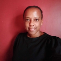
Ever logged a ticket to the Digital Earth Africa Help Desk? Do you come to our Weekly Live sessions? You may have already met one of our inspiring women from STEM, Victoria Neema. Victoria is a Junior Developer who supports the DE Africa mapping platform and assists the DE Africa user community. She also works as part of the DE Africa Science Team in assisting in the development of use cases for our Implementing Partners in their use of the tools and services. Victoria currently lives in Nairobi, Kenya, and is contracted through Kartoza, a South Africa-based free and Open Source GIS service provider. We talked to Victoria about her experience so far in the geospatial industry and as a member of the DE Africa team.
What motivated you to pursue a career in remote sensing?
“I was first introduced to the world of remote sensing in a fascinating class at the Technical University of Kenya in a class led by Dr. Simeon Kanani,” says Victoria.
Victoria continued to grow her skills with a final year project using radar imagery to map paddy rice in Kenya. Since then Victoria has grown both her experience and passion for a career in remote sensing by joining Kartoza first as an intern and in her current role as a Junior Developer.
Victoria believes remote sensing and GIS is a great field for others to consider as it is relatable to every aspect of our lives. “It is a very practical option that continues to evolve and will always be a relevant field in the science community”.
“With the rapid change of technology in this space there is always a new product or a new way of doing things so there is never a dull moment”.
What has helped you achieve your career goals so far?
“Being in great teams at both Kartoza and being a part of the DE Africa team has helped me thrive in my career,” says Victoria.
Victoria really appreciated the time her team members have spent teaching her new skills as well as supporting her with plenty of opportunities to put the skills into action. Victoria also really enjoys seeing the impact of her work in the communities utilising the information from the data and services.
Why do you think it is important to consider diversity in the GIS and remote sensing fields of work?
“Everyone has a place and a role to play in the (remote sensing) field.”
She highlighted that it is important to consider that being in the GIS/Remote Sensing field does not always mean technical, coding and mapping focused roles. “There are a lot of other roles that are just as important that support the work being achieved,” Victoria remarked.

This can include writing the documentation for tools and processes developed, or focusing on community outreach to help expand the reach of the data and services available. There are also roles in helping expand the reach of the information gathered through the use of services, such as DE Africa’s, by making it accessible to a wider range of people beyond the immediate Geospatial community. This can involve publishing articles, participating in events or even sharing on social media.
What has been your career highlight?
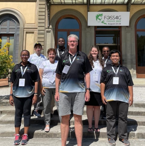
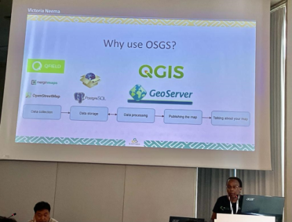
“Presenting at the FOSS4G 2022 Firenze on the Open Source GIS Stack (OSGS platform) I assisted in developing at Kartoza was a very big moment for me. Seeing a product from its early stages to sharing it with the world was an incredible journey to be a part of.”
How can you find out more?
The DE Africa Help Desk is a great resource for users to get assistance with the products and services, ask questions from the community and find a Knowledge Base of information and using the DE Africa products. Discover the Help Desk here.
The DE Africa user community can attend weekly live sessions to learn more about how to use the tools and services, get up to date information on what new features or data may be coming up as well as detailed discussion around a range of topics focusing on remote sensing applications.
Details on how to attend the sessions are here.
Catch up on sessions on our YouTube channel.
Some recent sessions have focused on Agriculture and Food Security, Crop Health, the new DE Africa Coastlines service and Water Extent.
About Victoria
Victoria is a Junior Developer based in Nairobi, Kenya. She completed her BA of Engineering (Geospatial Engineering) in 2022. Her journey with Python began when she took the Applied Data Science course offered by World Quant University, and she hasn’t looked back.