How Digital Earth Africa is supporting sustainable coffee production in Kenya
The DE Africa platform provides free and open data covering the continent of Africa, the satellite data is efficiently prepared into analysis-ready data offering the potential to harness the growing volumes of Earth observation (EO) data to solve a myriad of critical problems in agriculture.
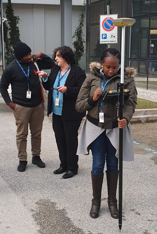
Geospatial Consultant Stella Mutai is using the DE Africa platform to support sustainable coffee production in Kenya. Her innovative work, which was recently awarded the Farming by Satellite Prize, from the European Global Navigation Satellite System Agency, unlocks the power of Earth observations to support the agricultural sector to adapt and mitigate against the effects of climate change. In doing so, it empowers communities in vulnerable areas to increase agricultural production and productivity.
The impact of Stella’s work is likely to increase agricultural yields and profits, improving food security for local communities of farmers - many of whom are women. Stella works for the International Fund for Agricultural Development (IFAD) as a geoinformatics and remote sensing specialist, focused on increasing food security in Africa.
Stella’s work relies upon the technological innovation of the DE Africa platform, which provides her with Analysis Ready Data (ARD) from Earth observations. She says
“The technical innovation on our project, ‘Earth observation for Monitoring and Informing Coffee Farming in Kenya’, comes from Digital Earth Africa. Typically, satellite images are expensive. They’re also distributed in a raw format and need to be processed which takes a lot of time. As a user, having access to regular, reliable, and operational data enables faster and better-informed decision-making, so timely and effective solutions are available to farmers and key stakeholders such as government agencies.”
Stella began working with the DE Africa platform after completing the free online 6-week training course.
“It is a great platform that’s reliable, easy and well understandable,” she says. “The training manuals are user-friendly, especially to those who aren’t geospatial experts. The platform has also provided me with ideas of how to improve my use case analysis and how to spend less time generating in-depth analysis. Lastly, the training manuals have well-explained material s making it easy for learners to provide a description of analysis from either a technical or non-technical perspective – this is especially helpful when speaking with policy or decision-makers.”
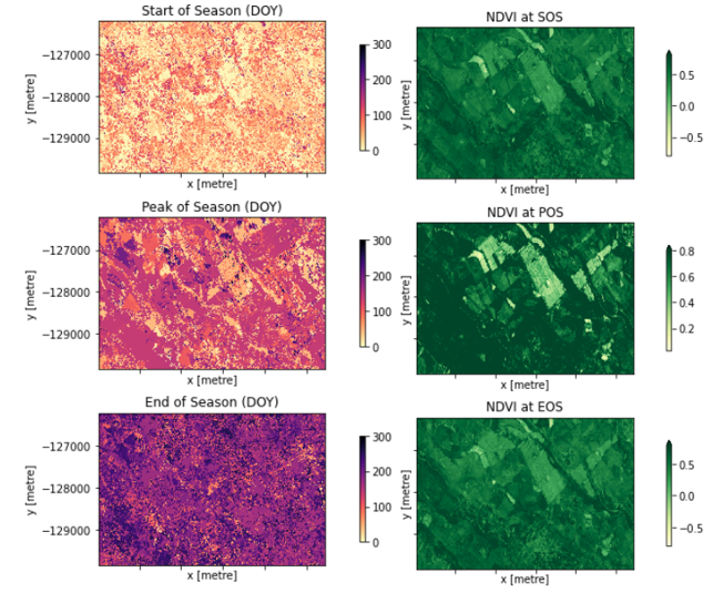
Stella’s main engagement with the DE Africa platform to date is to study vegetation phenology and correlate this with the weather patterns for coffee farming. She can do this by using DE Africa’s remote sensing algorithms that use normalized difference vegetation index (NDVI) and enhanced vegetation index (EVI) to study vegetation phenology and correlate this with the weather patterns for the coffee farming. The DE Africa platform offers Stella the opportunity to assess differences in agricultural fields both over time and across locations. It also allows for the assessment of vegetation phenology such as planting and harvesting. This has the potential to inform agricultural policies for Kenya to support UN Sustainable Development Goals, and African Union’s Agenda 2063 goals. Stella’s role at IFAD involves the use of EO in various projects across Africa to promote food security. In the future, she intends to use the DE Africa platform to support other areas of her work such as wetlands mapping in Djibouti.
About Stella Mutai

Stella Chelangat Mutai was born in Kenya, where she completed her Bachelor in Geospatial Information Science in 2016. From 2017-2019 she continued her Master's in Geoinformation Science and Earth Observation at the University of Twente, Netherlands. Stella has a passion for Geoinformatics and remote sensing. She is enrolling at International Max Planck research school for global biogeochemical cycles in Jena, Germany on March 2021 for her doctoral journey by focusing on the use of Data science approaches to the classification of ecosystem disturbances from use of satellite remote sensing/ Earth observations. Currently she works for International fund for agriculture development (IFAD) as their Geospatial consultant.