Digital Earth Africa is a powerful resource for policymakers and industry to gather insights and make informed decisions about sustainable development.
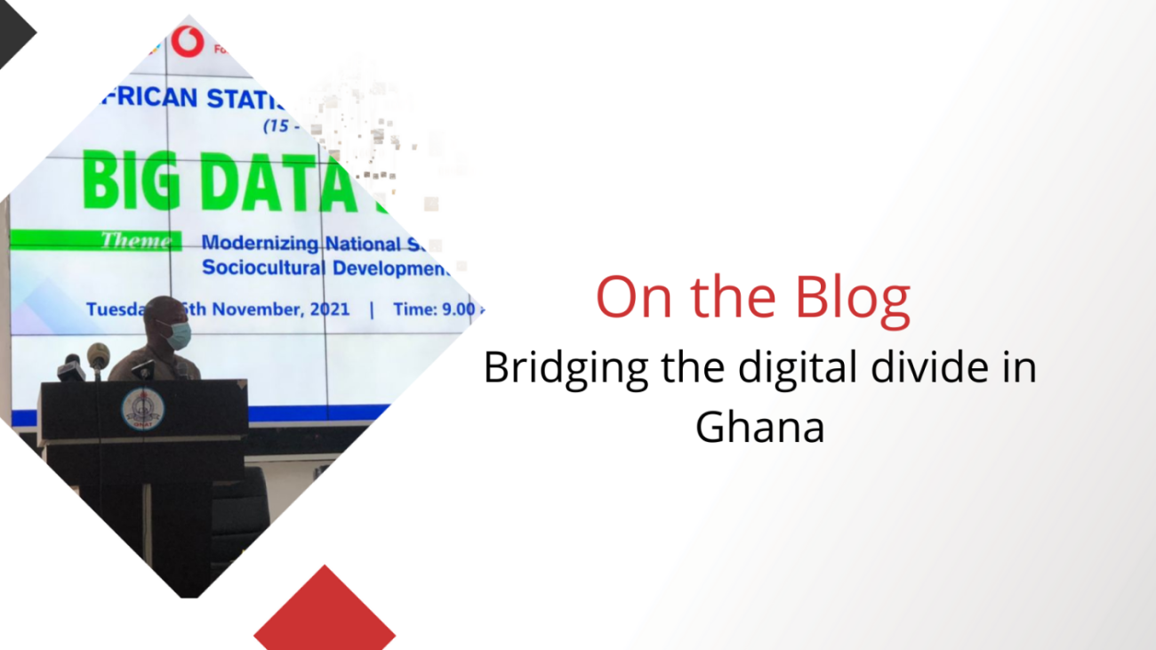
Policymakers in many countries across Africa, including Ghana, find it challenging to demonstrate meaningful progress towards their environmental sustainability goals due to a lack of access to the systems, frameworks and resources required to measure change. Access to reliable data is critical to monitoring progress in areas such as forest regeneration, water management and urbanization. Social Statistician and TAC Co-Chair Omar Seidu and his team from the Ghana Statistical Service have been using Digital Earth Africa in Ghana to strengthen the National Statistical System in order to meet the African Agenda 2063.
“To achieve the Africa We Want, we need to rely more on data,” - Omar Seidu.
The African Agenda 2063 is a framework to guide Africa’s development for the next 50 years. Developed by the African Union, the Agenda focuses on the broader economic, social, political, scientific and cultural development of the continent. It was adopted by the African Union Summit in 2015.
A solid foundation
Omar believes that Digital Earth Africa is bridging the digital divide for Africa.
Digital Earth Africa provides a solid foundation on which the Ghana Statistical Service can confidently build new systems and approaches. The platform provides free access to the quality data required to accurately assess the environment and landscapes across the continent. Omar believes that in order for National Statistical Systems to succeed, it requires a distinct approach guided by principles and international standards, and demands effective coordination and leveraging of data such as Earth Observation.
“I hope that an increased uptake in evidence based decision making will be observed with access to robust data and statistical systems,” Omar explains.
Why Digital Earth Africa?
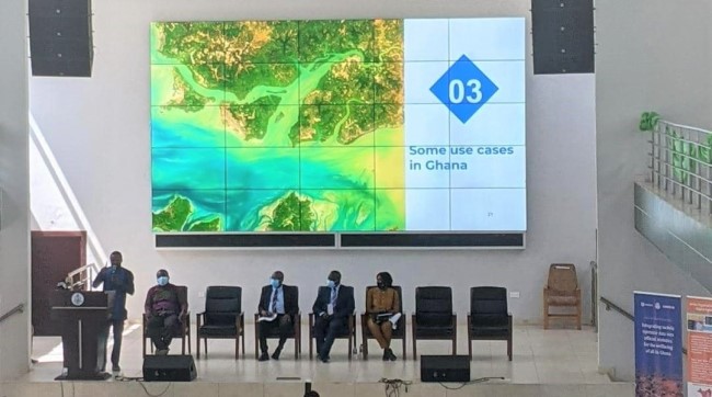
The Ghana Statistical Service chose to work with Digital Earth Africa because of the continent-wide, scalable data and services. Observations of land degradation, coastal erosion, urbanisation, water resources, agriculture, food security and deforestation provided by Digital Earth Africa are helping the Ghana Statistical Service to underpin their existing statistics systems.
In addition to ticking the boxes for data requirements, the DE Africa program also follows the principles of diversity and inclusion that align with the values of the Ghana team, and these clearly align with the vision and mission of the National Statistical System.
The partnerships already held by Digital Earth Africa across the continent and beyond were another key driver for the Ghana Statistical Service. Combined with the learning and support resources, this all contributes towards a community of users continually growing across Africa. In order to ensure the longevity of a National Statistical System, it was important to select data and systems that supported the Statistical Service’s users needs. The resources from Digital Earth Africa makes it easy to onboard and train new users as well as providing ongoing technical support.
Using Data in Ghana
Helping Parliament to reduce deforestation
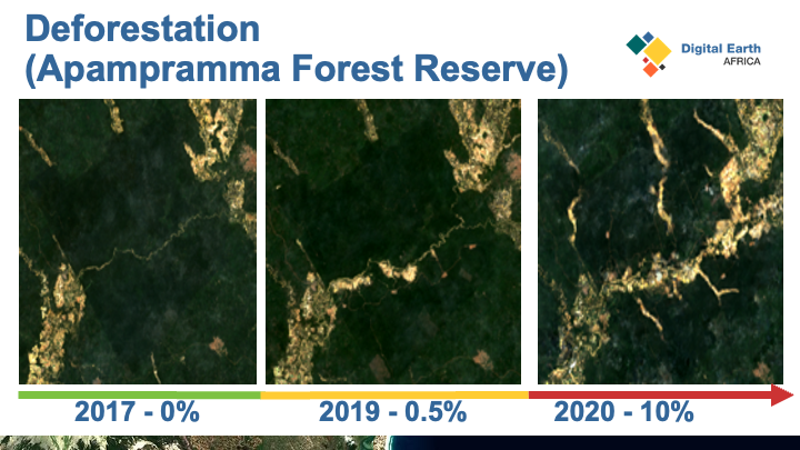
The Apamprama Forest, one of several protected areas in Ghana is experiencing rapid deforestation, in part due to illegal gold mining activities. In 2020 alone, 10% of the vegetation was lost. The Ghana Statistical Service collaborating with other government agencies, analysed changing forest extent by completing a Natural Capital Assessment using Digital Earth Africa data and services. Quantifying the loss of vegetation helped to demonstrate the significant changes to decision makers and advocate for a change in management of the area. The Natural Capital Report was provided to the Ghanaian Parliament and local authority, and resulted in a ban on logging and other activities to reduce deforestation in the area.
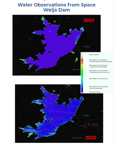
 Managing and maintaining important dam infrastructure
Using Digital Earth Africa’s Water Observations from Space service, the condition of Weija Dam, which supports the main water treatment plant for Accra, was assessed. Learnings were provided to the institutions that manage the lakes and were used to inform management activities.
Assessing urban growth
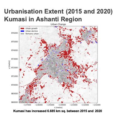
Urbanisation has also been examined in areas such as Kumasi, the second populous city in Ghana. Using historical data analyses, the Ghana Statistical Service team was able to go back 20 years to understand long-term changes to the population in this city.
Digital Earth Africa provides Ghana with the tools they need to realise the Africa We Want under the Agenda 2063. They have informed an important foundational system to ensure that continued monitoring and evaluation can be carried out for the country.
 The free services and the platform serve as an important resource for the entire continent to have accessible open data.
“Based on the success in Ghana there is immense potential for the other countries within the Africa continent to use the data and services to underpin their own sustainability goals.” Omar Seidu
Watch Omar’s Keynote at the GEOWeek Plenary here.
 Omar Seidu
Head of Demographic Statistics and Coordinator of Data for SDGs in Ghana. Ghana Statistical Services. Omar is a social statistician with over 18 years of experience in statistics production. He is a Fellow of the Sampling Programme for Survey Statisticians, member of the United Nations Inter Agency and Expert Group on the Sustainable Development Goals.