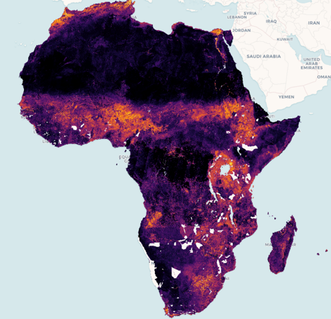
Digital Earth Africa is excited to announce that the provisional Cropland Extent Map now offers complete coverage of the entire African continent.
According to recent estimates over 281 million people across Africa, around one in five, faced hunger during 2020. The pressures on food security are the result of a combination of factors such as climate variability and extremes, the COVID-19 pandemic, conflicts, economic slowdowns and downturns and the affordability of healthy diets. Africa is already seeing the effects of climate change on food security with increasing frequency of droughts, increasing severity of extreme weather events as well as the impacts of pests such as locust swarms. To effectively address the issues generated by food insecurity, urgent, data-driven action is required.
The continental Cropland Extent Map is the culmination of over 18 months of co-design and validation in collaboration with a range of institutions across Africa including RCMRD (Kenya), AfriGIST (Nigeria), OSS (Tunisia), NADMO (Ghana) and AGRHYMET (Niger). The network of Digital Earth Africa partners across Africa were key to ensuring that this service is tailored to local needs and meets the real requirements of organisations, governments and individuals.
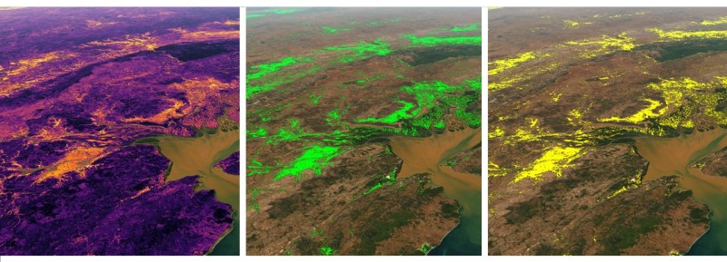
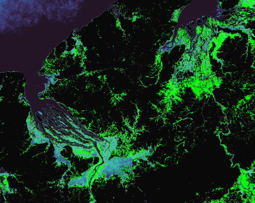
Cropland Extent Map
The Cropland Extent Map is designed to be an accessible way to understand the state of agriculture across the continent, focusing on accurate, high resolution data for all countries to enable consistent analysis. The provisional service indicates crop presence or absence as well as insight into the probability of crop existence to a 10 metre pixel resolution for the period of January to December 2019. It has been developed using Sentinel-2 satellite imagery. A detailed description of the methods used to produce the Cropland Extent Map can be found in the Jupyter Notebooks in DE Africa’s GitHub repository.
The service can be used for analysis within the DE Africa platform in conjunction with other services such as Water Observations from Space, rainfall estimates (CHIRPS) and surface temperature (Landsat) to understand the bigger picture and how it may affect agriculture. The data can also be used in the DE Africa Sandbox for more detailed analysis. Cropland extent is an important building block for more complex models such as watering intensity and crop type mapping.
This data helps even non-technical users to understand the footprint of agriculture across the continent and how rapidly this has changed over time. More than 60% of the Sub-Saharan population is smallholder farmers. It is important to understand the broader picture within local and regional areas to ensure agriculture remains sustainable when considering factors such as a changing climate, increasing economic pressure and the effect of rapid population growth.
Explore for yourself
Discover the data on the Digital Earth Africa Map.
Sign up to explore the data more using the Digital Earth Africa Sandbox
Learn more about the method and technical details in the Digital Earth Africa Docs
See this article for instructions on how to load, plot and conduct simple analysis with the Cropland Extent Map in the DE Africa Sandbox.