A central focus for governing bodies in Africa is to secure the necessary food sources so their populations can access safe and nutritious food to meet dietary requirements. It has been estimated that the current production of crops will need to double by 2050 to meet future needs for food production. The UN 2030 Agenda for Sustainable Development Goals (SDG 2) calls on governments and all stakeholders to end hunger, achieve food security, improve nutrition and promote sustainable agriculture1.
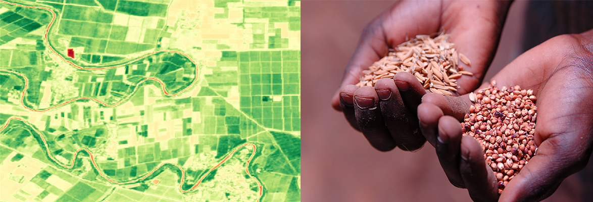
Using satellite imagery we aim to improve the management of Africa’s food crop production. Current cropland extent maps are either inaccurate, have too coarse spatial resolutions, or are not updated regularly. Higher level crop-based services available on the Digital Earth Africa (DE Africa) platform, such as the Cropland Extent Map, can assist with managing food insecurity by providing precise and accurate cropland extent maps that map crop watering intensities, crop types, and crop productivity. These crop-based services provide accurate, high-resolution, and regularly updated cropland area maps, and associated data sets for the African continent to address the gap in the current crop monitoring services.
Why is this Important in Africa ?
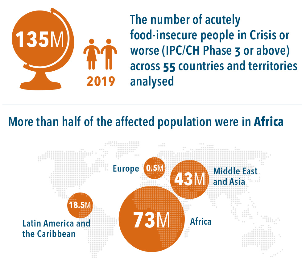
Africa is home to 75 million people who are acutely food-insecure, in crisis, or worse. This number continues to grow faster than anywhere else in the world2. It is estimated the current production of food will need to double by 2050 in developing countries to meet future needs. Current production is well below the levels needed to feed the population and two-thirds of the continent rely on imports to subsidise food shortages. Weather extremes are a major driver of food insecurity in Africa. Weather-related events can directly affect crops and/or livestock, cut off roads and prevent markets from being stocked. Adverse weather events are particularly serious for smallholder farmers in these regions, who cannot afford to invest in the systems and inputs required to withstand and recover from the impacts of such shocks, and for pastoralists who are vulnerable because they rely on rain-fed rangeland for grazing livestock and have limited fixed assets.
With the COVID pandemic continuing, it is feared food shortages will severely impact food security.
4. Food Security Information Network, 2020, 2020 Global Report On Food Crises, https://www.fsinplatform.org/sites/default/files/resources/files/GRFC%20ONLINE%20FINAL%202020.pdf
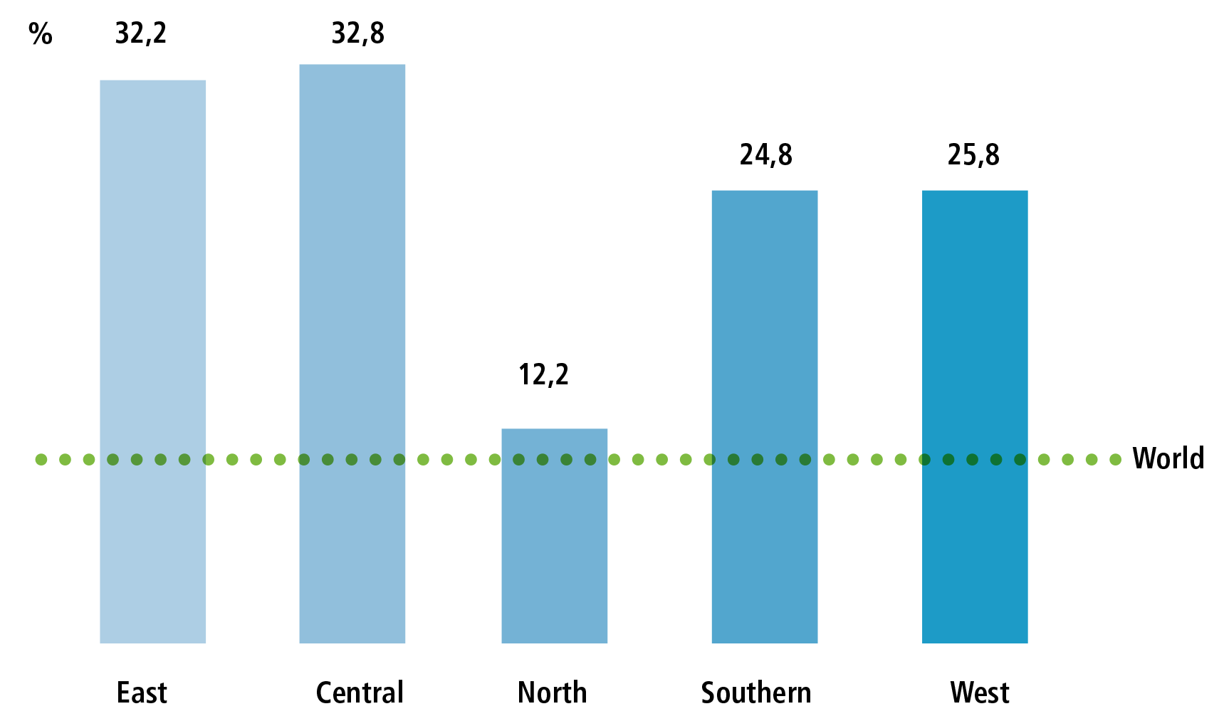
Prevalence of severe food insecurity (%) 2015
6. The Sustainable Development Goals Center for Africa, 2019, Africa 2030 Sustainable Development Goals Three Year Reality Check https://sdgcafrica.org/wp-content/uploads/2019/06/AFRICA-2030-SDGs-THREE-YEAR-REALITY-CHECK-REPORT.pdf
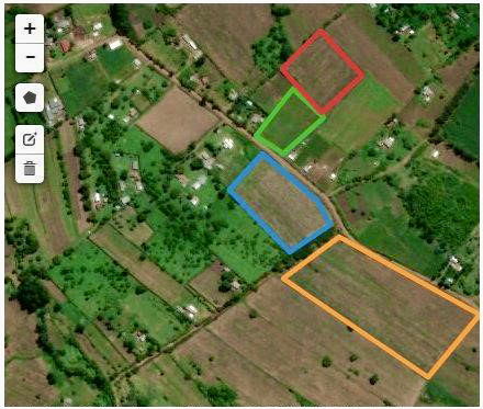
Cropland Mapping Service
Our continental-wide satellite imagery and crop-based services allow anyone to better understand the year-to-year spatial foot-print of food crop growth across Africa. These services provide up-to-date and ready to use information to improve food production strategies. They support farmers to monitor their land vegetation and improve outlooks on crop production, as well as supporting governments to ensure anticipated food volumes are accurate and identify potential food shortages early.
Agricultural productivity rates in Africa are often far from global best practice. Local farmers frequently miss accurate information about water availability and crop development. The continental scale cropland area mapping service, the Cropland Extent Map, provides a baseline environmental layer required for crop monitoring. The vital information and insights gained from regularly mapping food crops support farmers, scientists, and policy makers to understand how crops respond to variations in farming practices and the climate.
This information is valuable for understanding change over time to support optimised planting, fertilising, and irrigation practises as well as enabling yield forecasting. The ability to monitor change to farms over time through annual calculations of cropland extent also helps us to understand how agricultural productions are shifting in the context of a changing climate. The data can also provide a rapid, standardised and objective assessment of the biophysical impact of agricultural practices in terms of vegetation cover. This information can inform more sustainable agricultural practices and supports decision makers with information to call for restoration interventions when they are most needed. African countries can use the Cropland Extent Map to monitor and compare with neighbouring countries on seasonal performance so they can determine where to import food from. The the Cropland Extent Map enables national statistical agencies to target their crop sampling strategies for estimating food and fibre production.
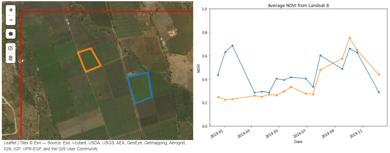
Crop Health Analysis Tool
We are developing a range of additional analysis tools to support users address agriculture and food security issues at a regional scale.
Our crop health notebook demonstrates how satellite imagery can be used to measure plant health over time and identify any changes in growth patterns between otherwise similar fields. The Normalised Difference Vegetation Index (NDVI) describes the difference between visible and near-infrared reflectance of vegetation cover. This index estimates the density of green on an area of land and can be used to track the health and growth of crops as they mature. Comparing the NDVI of two similar planting areas will help to identify any anomalies in growth patterns.
Additional potential technical products and services addressing agriculture and food security issues are outlined in DE Africa’s Technical Roadmap, which guides the development of our infrastructure and services.
Data Sources and Validation
Our crop based services use multi-spectral observations sourced from both the USGS Landsat and European Commission Copernicus Sentinel-2 satellite imagery archives. Our continental scale crop area map is being developed based on a supervised decision tree algorithm that considers surface reflectance measurements in selected spectral bands and a number of normalised difference indices.
The primary goal of the data validation strategy within the context of DE Africa is to provide confidence in the data services while also highlighting the limitations – where it works and where it fails – in order to enable the appropriate application by the end-users. We are actively working with African partners to assess the accuracy of the crop mapping service across the diverse environment of Africa.
Services, Products and Training
We are committed to provide a suite of services that cover the entire African continent, including analysis-ready datasets and services that translate Earth observation data into meaningful information for users.
There are a number of services all aimed at providing access to DE Africa data.
- The DE Africa Map offers user friendly map-based access to spatial data.
- The DE Africa Sandbox is a cloud-based user computational platform that operates through a Jupyter Lab environment providing users with access to data and analysis tools, democratising access to remote-sensing data to allow for ad-hoc report generation and rapid development of new algorithms.
- The Notebook Repository offers readily available notebooks (user computational workflows and code) to support advanced users to use, interact and engage with the DE Africa Sandbox.
With the help of our stakeholders we have co-designed a free self-paced online training program available on the Learning Platform to support users to work autonomously on the DE Africa platform. The training material includes modules made up of videos and recorded tutorials, manuals with hands-on exercises, live workshops and access to experts to get more help.
Learn more about how DE Africa services are being used to assess crop health in Kenya.
1United Nations General Assembly, 2015. https://www.un.org/ga/search/view_doc.asp?symbol=A/RES/70/1&Lang=E
2United Nations, 2020. https://www.un.org/sustainabledevelopment/hunger/
3FAO, 2009. http://www.fao.org/fileadmin/templates/wsfs/docs/Issues_papers/HLEF2050_Global_Agriculture.pdf
4Food Security Information Network, 2020, 2020 Global Report On Food Crises, https://www.fsinplatform.org/sites/default/files/resources/files/GRFC%20ONLINE%20FINAL%202020.pdf
4,5Food Security Information Network, 2020, 2020 Global Report On Food Crises, https://www.fsinplatform.org/sites/default/files/resources/files/GRFC%20ONLINE%20FINAL%202020.pdf
6The Sustainable Development Goals Center for Africa, 2019, Africa 2030 Sustainable Development Goals Three Year Reality Check https://sdgcafrica.org/wp-content/uploads/2019/06/AFRICA-2030-SDGs-THREE-YEAR-REALITY-CHECK-REPORT.pdf