Digital Earth Africa provides continental analysis-ready Earth observation data services. These services provide government, industry and researchers with valuable information and insights to help address social, environmental and economic change on the continent, develop an ecosystem for innovation, addressing the challenges of sustainable development across sectors.
Digital Earth Africa's Services include:
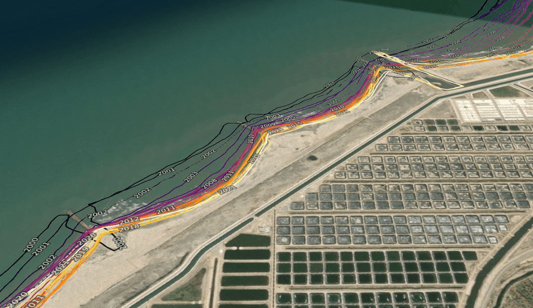
The Coastline monitoring service helps users identify and analyse the patterns of past and present coastline change across the African continent. Environmental degradation of coastal areas in Africa has a great economic and social cost and is affecting livelihoods. The Coastlines service captures all 38 countries in Africa which have coastlines. With satellite imagery available for visualisation on the interactive map and several analysis ready notebooks available on the Sandbox, the Coastline service enables decision-makers across Africa to accurately assess their coastlines with consistent geospatial data over large areas.
Learn more about the Coastlines service.
For more detail view the product specification on Digital Earth Africa Docs.
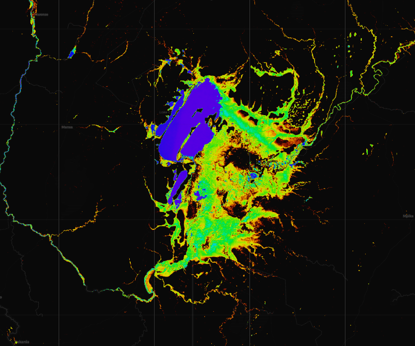
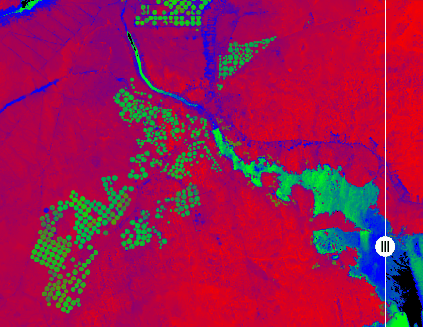
Water Observations from Space (WOfS) is a continent-wide service that enables users to better understand water availability anywhere in Africa. WOfS provides information on the location and change in surface water across the African continent.
It shows the presence and absence of water over the past three decades, and can be used to assess the change in water extent over time. This allows users across Africa to map, assess, visualise, and manage water resources and understand trends as well as extreme events.
Learn more about the Water Observations from Space service.
For more details view the product specifications on Digital Earth Africa Docs.
The cropland extent map identifies the presence or absence of crops and provides a reliable fundamental layer to understanding the location of agricultural activities. It can be used to underpin models of crop productivity, crop types or irrigation intensities when combined with other datasets. This service provides an accurate, high resolution map for the Africa continent for the year 2019.
This information is fundamental to developing more complex agricultural products and empowers governments to understand national food production and inform decisions on a country's food security.
Learn more about the Cropland Extent Map.
For more detail view the product specification on Digital Earth Africa Docs.
GeoMAD
GeoMAD is a rich data service with a suite of products that condense large image datasets into a single, high quality, image which is representative of the land surface over the particular time period. The Annual GeoMAD transforms an entire year’s worth of satellite data into a single cloud-free, statistically significant composite. The semi-annual GeoMAD service is also available for Sentinel-2 data, based on a six-month time period. And a rolling monthly GeoMAD is availble for even richer analysis.
GeoMAD data can be used to inform decision making on crucial sustainability issues such as water resourcing, flooding, coastal erosion, land degradation, food security and urbanisation, and is particularly useful for visualising change over time.
Learn more about the GeoMAD services. View the full product specification on Digital Earth Africa Docs.
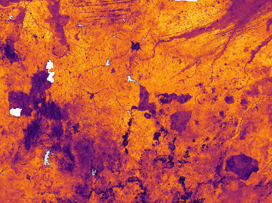
Fractional Cover
Fractional Cover is a service that describes the landscape by classifying the ground cover as bare, green and non-green. This enables analysis of environmental condition over time. The service uses Landsat 2 Surface Reflection therefore analyses can explore decades of change (back to 1980s to current day). This provides powerful insights into long-term annual as well as shorter term seasonal changes of vegetation on the Earths surface.
Fractional Cover can be used to analyse vegetation dynamics such as seasonal changes in agricultural and land practices, observe impacts of erosion and assess fuel load for estimating risk of fire.
Learn more about the Fractional Cover service, view analysis tools in the DE Africa Sandbox or view the full product specification on Digital Earth Africa Docs.
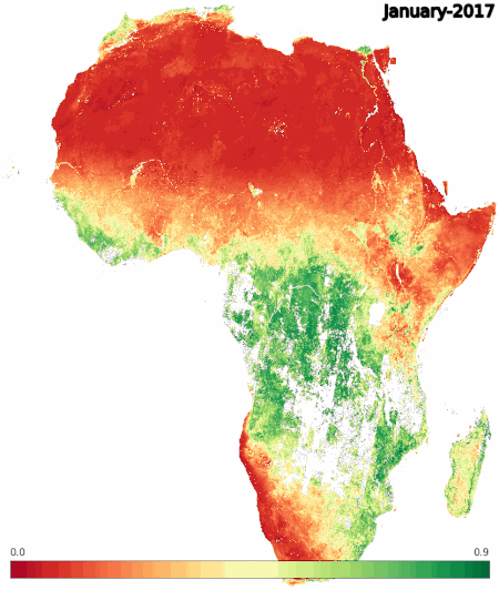
Mean NDVI and Anomalies
Digital Earth Africa’s Mean NDVI and Anomalies service provides a monthly estimate of vegetation health relative to the long term average conditions. This is determined by measuring how different the vegetation health is each month compared to the long-term mean for that month, measured in standard deviations. The service is designed to give users insight into how much the current vegetation conditions have changed relative to historic conditions. It can show improvement, maintenance or deterioration of the vegetation at each pixel across the continent.
The Mean NDVI and Anomalies can be used to analyse habitat and environmental conditions, seasonal changes, effects and risk of fire and the impact of a changing climate across a region.
Learn more about the Mean NDVI and Anomalies service.
View the full product specification on Digital Earth Africa Docs.