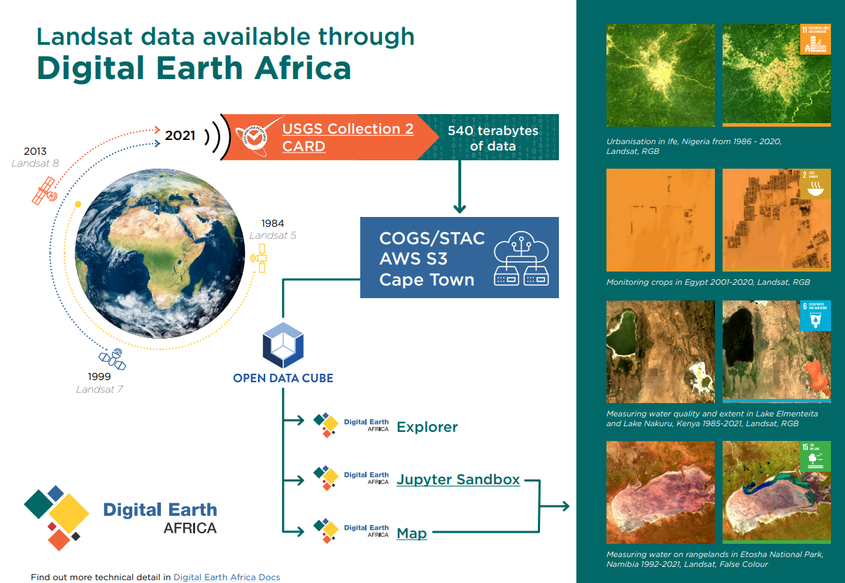
CARD surface reflectance and surface temperature from Landsat 5, 7, 8 and 9 are now available through the Digital Earth Africa platform.
The Landsat series makes multi-spectral land surface reflectance and land surface temperature observations available at 30 metre spatial resolution. Data is available from 1984 to the present day.
Tackling sustainability challenges
By providing long-term insights as cities grow, lakes rise and coastlines shift, the addition of Landsat data to the Digital Earth Africa platform provides policymakers, industry and researchers with a new, valuable input as they work towards a more sustainable future for Africa.
The new ARD can be used to map and mitigate a number of challenges pertaining to the UN’s Sustainable Development Goals and the African Union’s Agenda 2063.
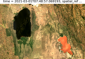
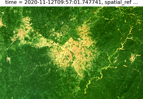
Mapping vegetation changes will allow for the detailed study of deforestation, helping to optimise reforestation efforts and inform best practice for carbon sequestration through the replanting of trees and mangroves. Monitoring crops is vital to understanding food production, food security and water management.
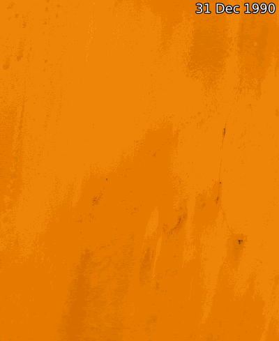
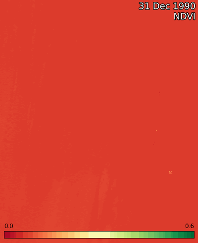
Monitoring crops in Egypt from 1990 to 2020 using Landsat in RGB and NDVI.
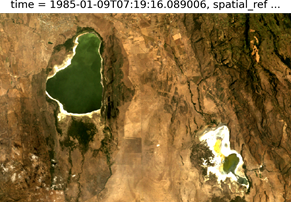
Monitoring rangelands will help to preserve this essential terrain and could provide a key input for optimising agricultural practices and wildlife conservation efforts.
Measuring water on rangelands in Etosha National Park, Namibia 1992-2021, Landsat, False Colour
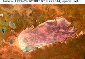
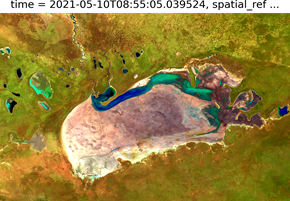
Studying water over time provides crucial information on factors like the extent and quality of water bodies. These vital inputs for water management practices, enabling decision makers to take action on urban planning, issues of food security and effective agriculture.
Measuring water quality and extent in Lake Elmenteita and Lake Nakuru, Kenya 1985-2021, Landsat, RGB
Measuring urbanisation helps to show how cities have grown over time and their effects on the landscape around them. By combining urbanisation data with factors like water extent, decision makers can plan cities to be more sustainable, improving the quality of life of those living in them, and minimising the impact on the natural environment.
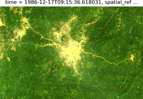
Urbanisation in Ife, Nigeria from 1986 - 2020, Landsat, RGB.
Discover for yourself
Landsat data is open and accessible to all users, regardless of your level of technical competency.
Visit Digital Earth Africa Docs for more information on Landsat Surface Reflectance and Landsat Surface Temperature.
Explore the data in the Digital Earth Africa Sandbox or Map.
Digital Earth Africa provides a free self-paced training course, making Earth observation data accessible to problem-solvers worldwide.
Landsat data is used to create the Water Observations from Space and support other services provided by DE Africa.