The open and free data provided by Digital Earth Africa is dependent on what is called Analysis Ready Data (ARD). This is Earth observation data that has been processed according to a set of requirements that allow immediate analysis.
Preparing data for analysis is a major hurdle to the uptake of satellite images. Traditionally 80% of project time could be taken up in accessing, pre-processing and organising satellite images. Analysis ready data is a game-changer and is critical if Earth observation infrastructures are going to be efficient, and sustainable.
Currently, Digital Earth Africa uses open and free ARD provided by international satellite programs, including:
- Landsat (USGS)
- Sentinel-2 (ESA)
- Sentinel-1 (ESA)
We use these datasets to create our tools and services, but we also make the datasets themselves available through the DE Africa platform. These datasets are processed regularly to ensure all the services, tools and platform data remains current and has consistent continental coverage. By providing the data in a more accessible format, a larger range of non-specialist users will be able to use its valuable information and insights. From simply identifying water resources for greater access to clean water through to the ability to regularly map food crops.
The Committee on Earth Observing Satellites (CEOS) ensures international coordination of Earth observation programs and promotes exchange and optimisation of data for decision making. CEOS Analysis Ready Data (CARD) has been processed to a minimum set of requirements and organised into a form that allows immediate analysis with minimal additional user effort. CARD also provides a level of interoperability, both through time and space and with other datasets.
Digital Earth Africa (DE Africa) hosts satellite data that meets the CARD Specifications. Landsat Collection-2 were the first datasets to be listed as CARD compliant. Collection-2 provides the fundamental starting point for DE Africa and is the basis for many of the information products and services such as the Water Observations from Space service.
Another crucial data source is Sentinel-2, which provides more frequent and higher spatial resolution observations from 2017 onwards. The Cropland Extent Map and GeoMAD services are based on Sentinel-2 data. The Sentinel-2 data DE Africa hosts have been converted from ESA provided CARD into cloud optimised format, and are under peer review for CARD compliance.
DE Africa also provides Sentinel-1 backscatter that meets the CARD specifications. Sentinel-1 synthetic aperture radar data provide important information on land cover and gives users the ability to ‘see through’ clouds - critical to monitoring vegetation in the wet tropics.
DE Africa will work with satellite operators and encourage their efforts to routinely observe Africa, and to operationalise CARD-compliant data. This improves the sustainability of the DE Africa Program by removing the burden of producing and maintaining bespoke approaches to data processing. It also ensures that datasets are processed consistently and are compatible with global datasets.
To find out more about Analysis Ready Data and what it means for DE Africa, check out the following resources:
- DE Africa blog’s on Analysis Ready Data for Africa.
- CEOS’s Introductory Webinar to Analysis Ready Data, featuring DE Africa’s Dr Adam Lewis.
- DE Africa’s Technical Roadmap.
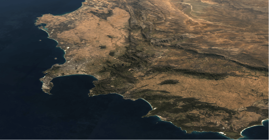
This seamless cloud-free image of South Africa, looking north over Namibia and Botswana, is in fact the median of hundreds of images taken throughout 2018. This processing is possible because the source Landsat images are processed to CEOS Analysis Ready Data Specifications.