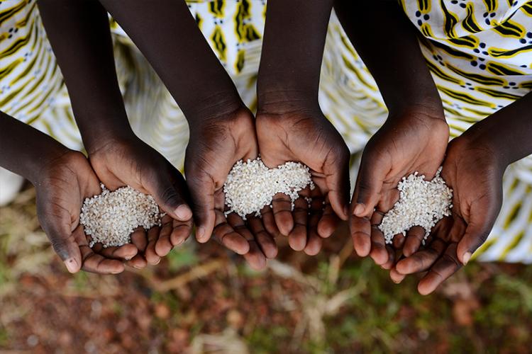
Food security is a fundamental human right and means people have access to enough safe and nutritious food that meet dietary requirements at all times. It has been estimated that current production of crops will need to double by 2050 to meet future needs. Two-thirds of African countries are net importers of food and with the COVID-19 pandemic not yet reaching its peak, it is feared food shortages will severely impact food security. The impact on supply chains in Africa could result in a crisis in Sub-Saharan Africa, as flagged by the World Economic Forum, hindering efforts to achieve the UN Sustainable Development Goals (SDGs).
To help address this rise in food insecurity and support SDG2 (zero hunger), the Digital Earth Africa (DE Africa) Technical Advisory Committee endorsed a cropland area map as the next product to be developed by the program. Chad Burton is the project lead and gives some insights into the product and the development process.
What is a cropland area map and how will it help address food security?
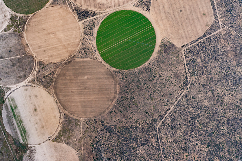
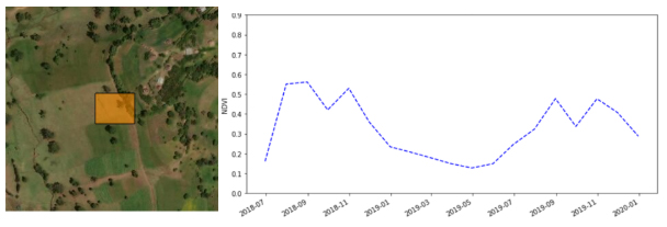
A cropland area map is a baseline environmental layer required for crop monitoring. It helps us accurately define areas of farmland that has been sowed and harvested at least once in a year. The ability to monitor change to farms over time through annual calculations of cropland extent helps us to understand how agricultural productions are shifting in the context of a changing climate.
The vital information and insights gained from regularly mapping food crops will support ministries and state departments of agriculture, international organizations, academia and industry to make more informed decisions for improving food security. African farmers and scientists can use this information to study how crops respond to variations in farming practices and the climate to make better decisions around agricultural development. It will enable national statistical agencies to target their crop sampling strategies for estimating food and fibre production.
With the reduction of food imports into Africa due to COVID-19, countries will also be able to use the continental-wide cropland map product to monitor and compare with neighbouring countries on seasonal performance so they can determine where to import food from within the continent.
How is DE Africa approaching product development?
The DE Africa Technical Roadmap guides the development of all products with the core objective that they are responsive to the needs and priorities of Africa. It is based on a user-centric and co-design approach to ensure products are fit-for-purpose and will achieve uptake. A Task Team has been formed by users and experts from African institutions and will be actively engaged in every phase of the product development lifecycle from Prototype, Beta, Provisional through to Operational phases. The Task Team includes:
- The Regional Centre for Mapping for Resource Development
- Group on Earth Observations Global Agricultural Monitoring Initiative
- Ghana’s National Disaster Management Organization
- The Global Partnership for Sustainable Development Data
- African Regional Institute for Geospatial Information Science and Technology
- The Sahara and Sahel Observatory
- AGRHYMET Regional Centre
The project is currently in the initial stages of Prototyping and follows a series of stakeholder interviews to plan, analyse and design the project plan. Key product requirements discussed included the need for the most recent data, that it can help improve existing products such as the GEOGLAM crop-monitor, the ability to target crop sampling, and the ability to conduct annual calculations.
Comparative benefits to existing cropland products
The DE Africa cropland area map product will address a number of gaps identified in existing Agriculture monitoring tools. It will:
- provide a consistent up-to-date map using the latest satellite data
- be reproduced annually, rather than once-off
- be a ready to use service accessible through the DE Africa platform, rather than running through software
- provide continental coverage
- have high spatial resolution of 10m
- be co-designed with African partners to fit their needs
Having the most recent high-resolution cropland area map supports longstanding food security related challenges. It will help inform COVID-19 response and recovery, as well as other critical challenges from locust swarms to extreme climate events. In addition to SDG2 to end hunger, the ability to improve crop production through the use of satellite imagery is also directly relevant to SDGs 6 (clean water and sanitation) and 15 (life on land).
More information
- Visit our Food resources data product page
- Visit our Water resources data product page
- Download our managing food resources postcard
About the author
Chad Burton is an Earth Observation scientist who has a keen interest in understanding and mapping environmental change to better inform environmental decision making. Chad has a Master’s in Environmental Change and Management from the University of Oxford, and a Bachelor of Science (Honours) in Geosciences from Monash University.